|
Many thanks for permission to use graphics from their software and toposheets |
|
|
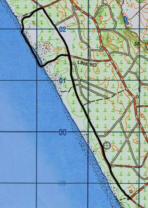
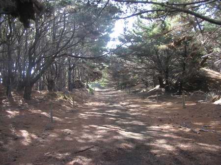
Rimmers: Coast Road North Section
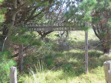
The Rimmers Carpark is at the bottom of the map. Link Rd, near the top, is a vehicular access (4WD only) to the beach, and leads to the (official) motor cycle courses. North of Link Rd the coast road continues for about a kilometre at which point the forest for the next 4 kilometres is in private ownership, and is not accessible to the public. The route shown on the map from Rimmers carpark and return is approximately 9.2 km. Just through the gate from the carpark is a large open area. I would hazard a guess that it is the original road end and carpark for Rimmers Beach,
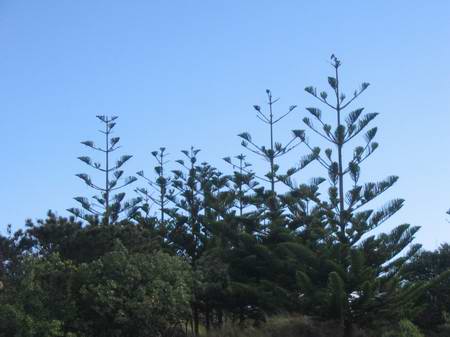
before CHH took over, as the dunes immediately between it and the beach have been planted in a variety of more interesting species including pittosporums and Norfolk pines, and there is an old warning sign to would-be swimmers. Nobody arriving here today is going to see this sign before drowning. Certainly neither of my boys, who have been surfing here with their mates since they were about 16. It took a great white shark sighting to discourage them in the end.
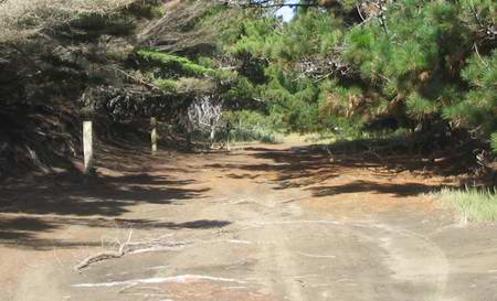
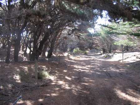
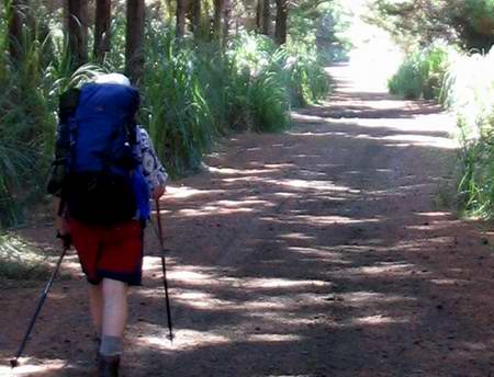
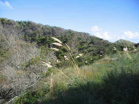
Head straight on to where an old pine has crashed across the road, and make your way past to the right of it. A little further on the immediate future is spread out before you. Unlike the south route, this end is almost all "tunnel" through the pines. (I walked this way recently to find that motorbikes had transformed the southern end of the road into a series of deep undulations, a larger version of what happens to gravel roads when cars persistently travel too fast along them. For walkers, rising and falling 300 - 600 mm every 5 metres or so is laborious. I fire out a terrible curse directed at heavy and repeated contact between bike seats and testicles.)
A kilometre or so later, the road has flattened out somewhat, but the overall scenery remains consistent. (If you have trouble with the strobe effect of dappled shade as you walk along, it may be better to head into the sun along the beach and back through the forest with the sun behind you. In the extra bright summer sun, this can be a problem, less so in winter.)
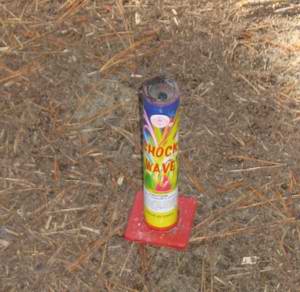
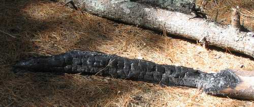
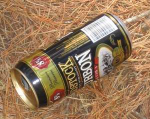
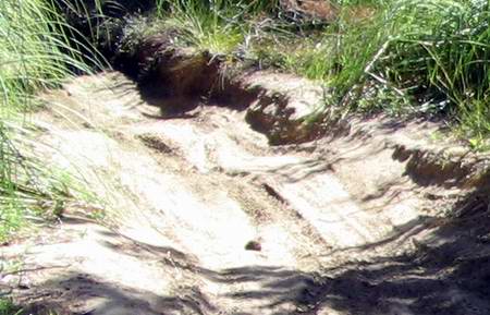
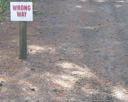
Every now and again we see something that reminds us there is absolutely no limit to human stupidity, as the next couple of pix demonstrate:
and, to be expected in the circumstances
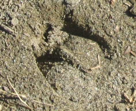
Here and there are signs that human beings, horses, dogs and motorbikes are not the only inhabitants of this piece of land. A fallow deer herd, or several of them, roam the forest and hunters ballot for a section of the forest to shoot in during the season, from early June to mid September.
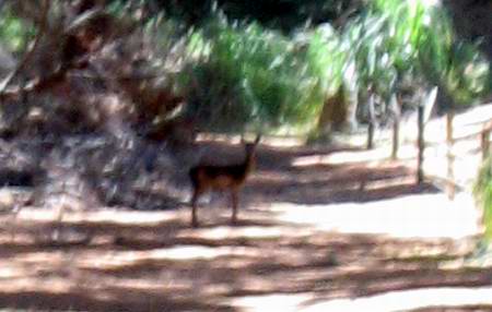
Normally these areas are clearly posted, and hunters are restricted to hours when the public is not likely to be around. Poachers, however, are not known for observing such niceties and for this reason it's a good idea to wear something brightly coloured. CHH warn that from time to time, walkers may expect to meet armed persons in the forest. Now and again you even get to see a deer. Last time through we saw 5, but only one remained in camera range long enough for me to grab a long distance snap shot
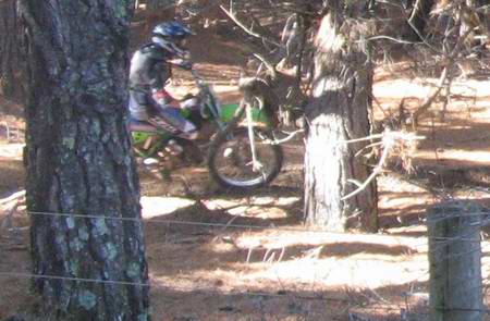
Just inland of the track, and fenced off, is an offroad motorcycle course and every now and again you hear the odd one approaching and see it flash past through the forest. About 3.2 km north of the Rimmers carpark, at the end of Link Rd, is the main offroad recreational centre in the forest.
We cross Link Rd and pick up the coast road on the other side.
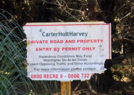
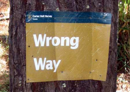
The sign says a good deal about the CHH policy with respect to recreational facilities. The lookout and picnic grounds on Selwyn Rd have been locked out all summer and last time out the access to the public lookout on the right, just after Selwyn Rd, had been wall-and-ditch barricaded to prevent public access. We continued, following a road covered in wheel tracks and intercepting unofficial motorbike tracks at regular intervals.
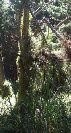
To the left is a wonderful example of muehlenbeckia climbing a pine tree - about 6 metres at least, I'd reckon.
We carry on along the coast road.
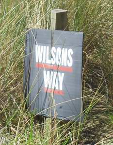
What is this? A motorway?
And another. Obviously directed at motorbikes, as the 4WD tracks on the road carry on regardless.
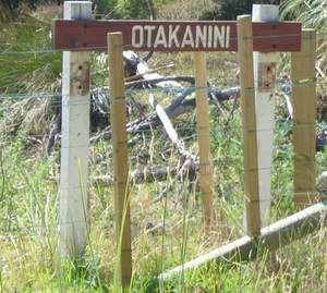
About a kilometre along we reach the Otakanini Forest. While there are no Keep Out signs per se, the place is bristling with brand new fencing and a system of double electric wires a foot out either side of the fence, about 900ml off the ground. If it's alive it sends the clearest posible message. We hang a left towards the beach.
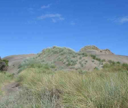
We head out round the back of the big shore dune. Miranda has ordered up a little high cloud and there it is.
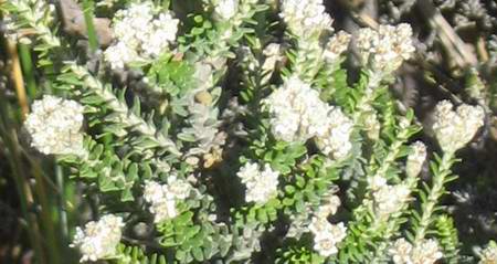
The tauhinu is currently in flower. At one point, there was talk of growing this as a cash crop, as it contains one of the precursor chemicals used in manufacturing contraceptive pills.
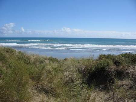
We follow a rough foot track, though I doubt it's been used much recently, and there, just ahead, is the coast.
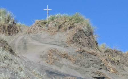
Down the dune, and onto the beach and about a kilometre back to the beach access road. Don't know what this one commemorates but they have a way of appearing near the sites of fatal motor accidents
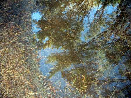
A packs off rest when we reach the coast road, then back to the car. After recent rain, despite the sandy soil, there are often large sheets of surface water along the road and these have an attraction of their own as well.
From time to time there is a gap in the pines and you can scramble out for a slightly different perspective. Here you can see the forest sculpted by the wind as it comes over the dunes. You couldn't do it much cleaner with hedgeclippers.
Heading back to the car, we pass the small stand of Norfolk pines and pittosporums, thankful for the shade we have had pretty much to ourselves on such a blue dome day.
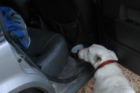
Back through the large green open space, and into the car. The dog on the occasion she accompanied us, complained that I walk just a little too far for her now she is getting on a bit. I get her bowl and fill it with water from the container in the boot. She drinks about half of it and places her two front paws on the sill of the car door. And waits. Shame, I tell her, and lift her into the car.
Paper RoadsPublic right of access along marked roads such as these is at times contentious. Bearing in mind the designation of the forests - and farms - as "workplaces" by the Health and Safety in Employment Act, and the consequent responsibility placed on management to ensure hazards are eliminated, minimised, or managed to avoid harm to workers or visitors, please observe signposted restrictions. (Especially where roads are unfenced, and often unformed, this responsibility to maintain a safe environment for visitors is one of the main reasons that farmers have chosen simply to put up NO TRESPASSING signs. Besides the problems caused by thoughtless visitors leaving gates open and such, the government is not at present indemnifying farmers against harm suffered by casual and unannounced visitors, whether using "paper roads" or crossing private property. Nor is it proposing to do so. Nor is there any assistance available to fund fences bordering such paper roads. This underlies farmers' opposition to the free right of public access to significant waterways proposed by the government. It is sometimes difficult enough maintaining a safe environment for those accustomed to rural hazards. CHH themselves are frequently involved in tree felling and pruning, activities which can be dangerous to members of the public, and there are many groups - motocross, BMX, horse trekkers, deer hunters and so forth- whose activities are potentially hazardous in the presence of casual pedestrians. For this reason, many areas of the forest are limited to specific activities and certain hours of access. If you wish to continue north, the privately owned section of forest is relatively small - about 4 km up the beach - and a sideways trip to the beach is not a big deal. You can rejoin further north where CHH resume ownership of the forest.
|
|