Background information and maps originate from Manukau City Council publicity material. The photographs were taken on several visits during late April, 2010.
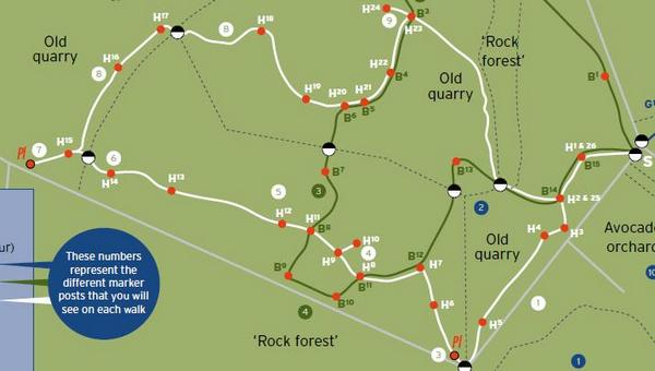
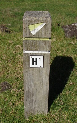
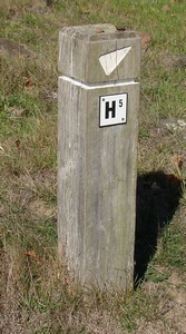
The History Trail is marked above in white. The numbers H1 to H26 refer to square wooden posts in the ground carrying these numbers. Black and white circles mark the position of gates. White circles on the map containing numbers 1-9 refer to one or two word descriptive notes in Manukau CC information leaflets. I shall refer to these as we move along the trail photographically. The pale grey lines are drystone walls built by pakeha.
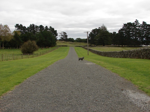
We park the van at the gate in Ihumatao Quarry Rd.
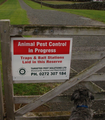
Alice wants to know just how serious this is, and whether the bait stations are accessible only to vermin or if the poison is just scattered on the ground as it was at Whangarei Heads.
I don't know about secure stations - I haven't seen any such as are common around the Waitakeres and elsewhere. The Fathmandu rule of thumb is as follows: The baits tend to be dangerous for up to six months, as a rule. The signs last for considerably longer as they are seldom if ever removed, so a judgement is made based on the degree of fading on the sign, and the amount of rust on the fastening rivets or staples. I'd reckon we're probably OK.
[Postscript: When we walk the Botany trail, we discover a number of these nailed to posts inside the rock forest at the start of the trail. They would be accessible to dogs, but they're probably out of the way for most purposes.]
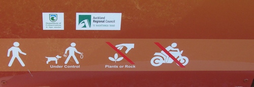
Alice is delighted to be made welcome, too. Under control? Of course! You will notice that the dog owner on the sign is carrying a poo bag, an example to all of us.
That telegraph pole puzzles me. It has no wires of any sort attached, and I wonder why, in the only section of the stonefields that is maintained in parklike condition, it continues to claim a place. Perhaps it needs a plaque to explain that it has historic value. Was it part of an electricity supply to local holiday baches or quarries?
We begin the history trail proper at the end of the avenue, where a plaque maps the several trails.
Through the gate and turn left up the hill. At the bend in the road is H1, our first marker pole.
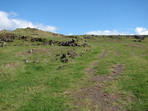
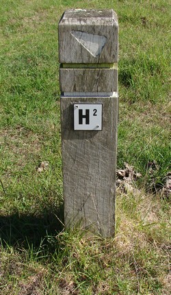
We head on up the hill towards H2. To the left of the track there is a small area fenced off from public or cattle access, containing a number of whau trees and a patch of the critically endangered NZ cucumber, mawhai, Sicio australis. The stonefields are one of the few areas where it continues to be found in the wild.
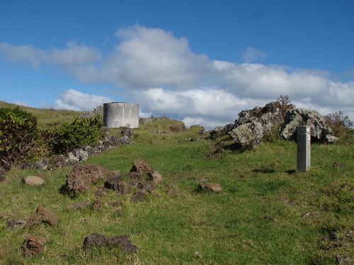
Around to the left a little is a concrete water tank. I was short of time to take a close look, but there is no obvious source of water. nor any obvious use for it except perhaps originally to irrigate the young avocado orchard when it was first planted, and maybe now to secure a water supply for the patch of mawhai.
I note in one of the Manukau CC documents associated with the site a reference to a house originally sited in the stonefields area but now relocated at 261 Ihumatao Rd. 261 Ihumatao Rd appears to be the former Rennie homestead, and well established on site. I later learned that the building in question had been burned to the ground some six months or so beforehand, and it's charred remains are visible a little further along Ihumatao Rd.
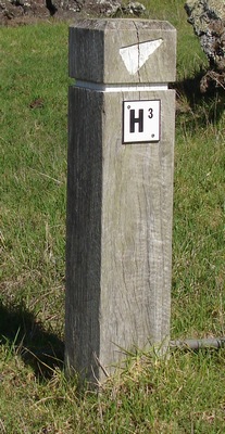
We head on up and around to H3
In the immediate area there is a largish and relatively flat area of pasture, heading across to H4, and then a sudden drop to another former quarry.
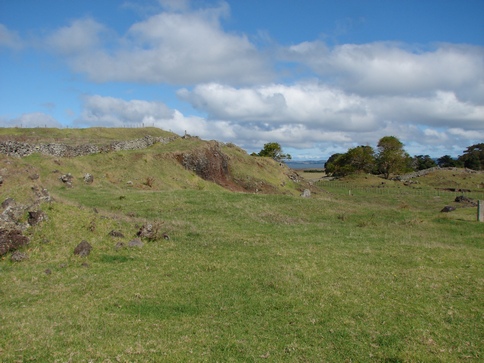
H4 is to the right of the photo; H5 is visible on the lower ground near the end of the ridge.
On our map, the area up top to the left and over the fence is designated "pa". Another visit for a more detailed look, as I am a little constrained for time this afternoon. The notes comment that much of the old Otuataua Pa site has been quarried.
[Later, I learned that the Ihumatao volcano had been a major source of scoria for Manukau City Council engineering projects, and when they closed the quarry, an effort was made to "reconstruct" the volcanic cone. For a closer look, click here.]
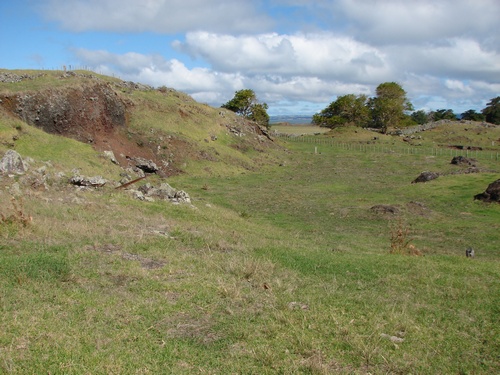
We pass H5
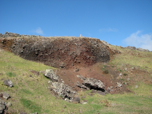
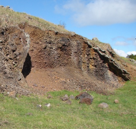
and to the left we can see the two sides of what I take to be a volcanic shaft, filled with scoria rubble. (There are geological terms such as tuff and scoriaceous and so forth that I am still getting my head around.)
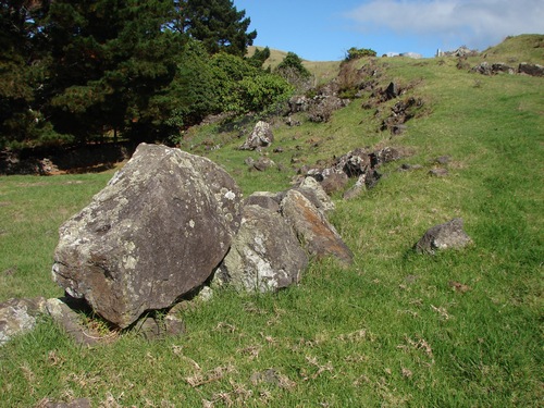
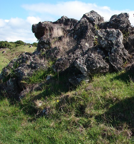
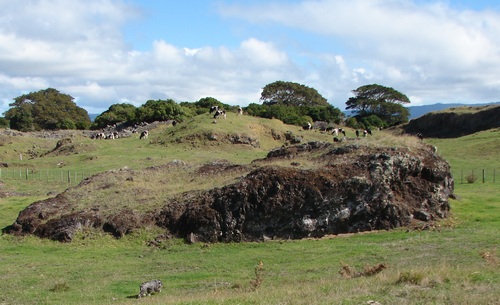
Behind us is a large central rock massif. These have the ability to soak up the sun's heat and retain it well in the evening to provide a warm surrounding microclimate. Several of the valley gardens have man-made rock mounds in the middle, for the same purpose.
There's a very large one over near the coastal walkway, about 5 or 6 metres high. The area must have been quite spectacular for a while with pieces this large flying through the air. There is a useful and detailed account of the four volcanoes in the immediate area by Ernest J Searle to be found in the NZ Journal of Geology and Geophysics, Nov 1959, pp. 870-888. See also [1]
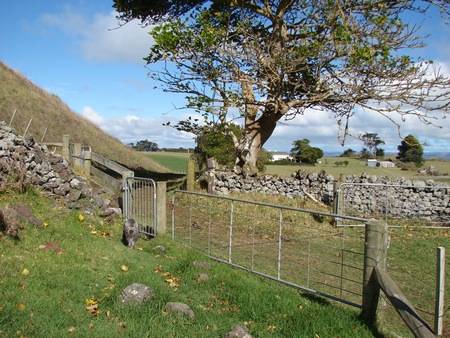
We head along to the gate that separates us from the cows. The steep slope to the left is part of the Otuataua volcanic cone.
Just around the corner is an information plaque that details some of the practices of Maori gardening.
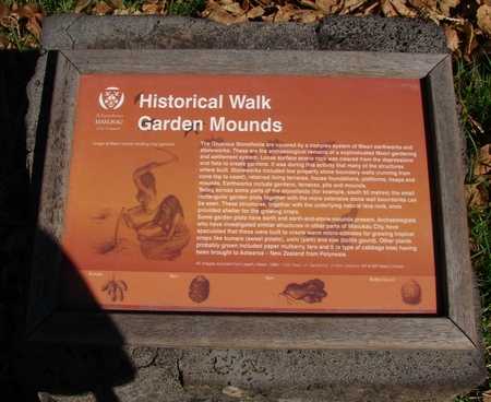
It mentions some examples of the rock gardens about 50 m to the south, which by my reckoning is in the next paddock, and separated from us by a rusty looking strand of wire running loosely along the top of the stone wall. Later on, Alice will provide me with convincing evidence that this rusty looking bit of random wire is in fact an intact and functioning electric fence. It would be possible for someone a little fitter and more agile than I am to make his/her way past it, but I am no longer as confident as I would like to be, and I don't want several million volts of electricity coursing through my sensitive parts, no matter how little the amperage might be.
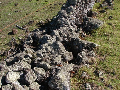
I may be wrong about this, but I assume that, locally, walls erected by pakeha are those utilising English drystone techniques, and are relatively narrow at the base, whereas earlier walls constructed by Maori are almost equilaterally triangular in cross section. Much of the drystone is in need of repair, but I don't know how much "repair" is considered kosher on an archaeology site.
[1] City of Volcanoes: A geology of Auckland - Searle, Ernest J.; revised by Mayhill, R.D.; Longman Paul, 1981. First published 1964. ISBN 0-582-71784-1