There are several levels of experience at which we can assess the value of a walk. At the first level, the rewards are immediate and easily accessible. A bush walk in these terms is an experience of shadow and colour, of smells, of sounds, of terrain, of snatches of sky, and so on. At a second level, any area of bush is a community of plants, birds, animals and insects living in relationship, and to experience the walk at this level requires a degree of expert botanical and zoological knowledge.
A walk through a site that is of archaeological, historical, and geological interest may be quite unrewarding at the first level of experience, but the walk can nevertheless be a rich experience once the effort has been made to acquire a little knowledge. |
... So, for example,
you don’t go and tell the pipi how to live, you allow it to have the opportunity to live the way it knows best, and that is what kaitiaki is. ... (Hohepa Kereopa, tohunga)
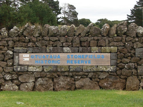
This 100 hectare reserve (or 89 hectares, depending on where you get the information) is managed by the Manukau City Council. It was set up in 2001 and opened by the Prime Minister, Helen Clark. It is administered in association with the Department of Conservation, the Auckland Regional Council, tangata whenua from Makaurau marae, and the Historic Places Trust. (ref Manukau City Council brochure) There is some suggestion that the divided oversight has frustrated effective maintenance and development, and with finance for this coming primarily from Manukau and ARC ratepayers, budgets are simply not adequate at present.

The Otuataua Stonefields are one of two remaining volcanic fields of the many that once covered 8000 hectares in the Tamaki isthmus. These fields were once densely settled and cultivated by Maori. The stored warmth from the sun was held in the underlying volcanic rocks and provided an extra month to six weeks growing season for kumara, and for taro and yam. In fact the entire Mangere area with its volcanic soils was prime market garden land before it was swallowed up by housing projects.
Settlements on these fields were probably the largest and most densely populated in New Zealand. The archaeologist, Rod Clough, has located some stone formations that he estimates as at least 1000 years old. The remnants of these settlements have been almost fully destroyed over the last 150 years by urbanisation and farming, and these stonefields provide a rare set of information for archaeologists and students concerning traditional life and customs.
Even so, the reserve area contains three former quarry areas, a holiday bach site and drystone walls erected by the original European farmers in the area, and the former Otuataua Pa on adjoining land has, according to one information source, been almost completely quarried.
Descendants of Te Wai O Hua, the earliest Maori in the area, are still living next to the Stonefields at Makaurau Marae, and the stonefield area together with the volcanic cones Puketaapapa (Pukeiti) and Otuataua make up an important part of their sense of identity, their whakapapa.
The report prepared for Manukau City Council by Makaurau Marae gives a concise history of the area, reproduced in part below.
The area is of historical importance to Pakeha as well. Four of the local farms have remained in the same families, the Mendelssohns, the Elletts, the Rennies and the Wallaces, for several generations, and the first Mission Station on the Manukau Harbour was established here in 1847. On his farm adjoining the reserve, Trevor Ellett spotted a variant rye grass patch that seemed to be thriving relative to the rye elsewhere on the farm and saved the seed for development. It has been estimated that the subsequent strain of "Ellett's rye grass" has been planted on somewhere near 40% of New Zealand farms, and it has featured strongly as a parent in the development of modern cultivars.
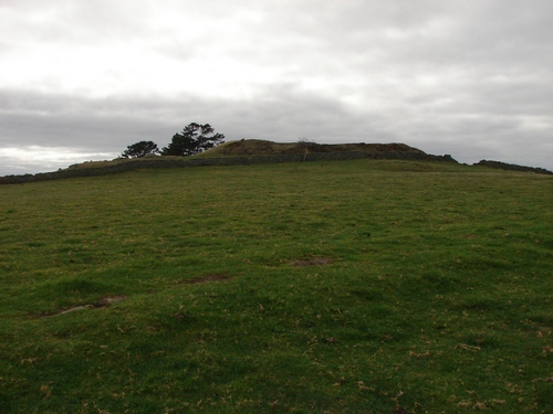
Over to the right of the main gate is the small volcanic crater, Puketaapapa (Pukeiti), traversed by the Geology Trail, and we'll get to that later. It is one of several locations of especial significance to Maori, and access to the summit area is limited.
Information sheets supplied by Manukau City mention that local Maori have requested that visitors stay off the summit of Pukeiti, and refrain from bringing food into the reserve area. However, nothing in the signage at the entry or elsewhere makes any mention of either of these concerns. This is perhaps something that needs to happen if the concerns are serious ones.
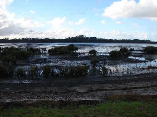
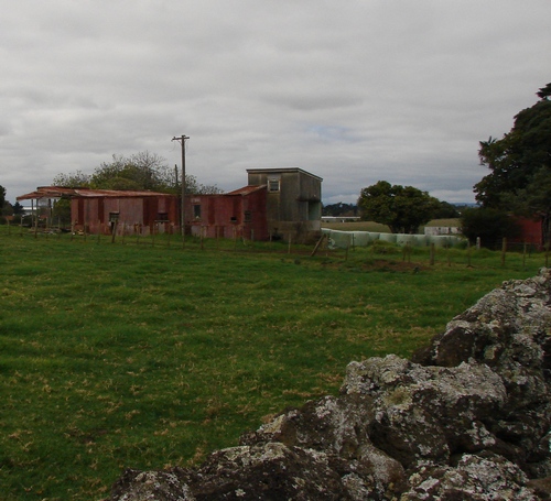
Before the area was developed in the sixties to process Auckland's sewage in large outdoor oxidation ponds, there were a number of holiday baches along the shore of the Manukau Harbour. Their attraction as hideaways disappeared confronted by the pervasive fragrance of the ponds and the arrival of midges in great swarming clouds.
You can imagine the effect of this on the people of Makaurau Marae for whom the area was not just a hideaway but a home and a history, a source of cultivated food, and of kai moana. With local kai moana sources covered in oxidation ponds, and the route to the nearest fishing grounds barred by a 950 hectare "NO GO" harbour area surrounding the airport, life became considerably harder for those living close by. (On the positive side, the area no longer receives the effluent discharge from the freezing works.)
Subsequent to the closure of these ponds, much of the land has been sequestered as reserve and bird sanctuary, and a "coastal walkway" takes you from Ambury Farm Park along the coast until it vanishes in rampant kikuyu, and a barbed wire fence prohibits further progress. There are a couple of birdwatching hides along the way, providing an opportunity for closeup viewing of a rich local wading-bird population. I believe this walkway, or at least part of it, is included in Te Araroa National Walkway.
Note: While the Stonefields Reserve regulations permit your dog to accompany you, either on a leash or under control, there is a ban on dogs along the coastal walkway, which appears to be a DoC reserve.
If the term is appropriate, and I think so, DoC's attitude to dogs might well be described as rabid. ARC and Manukau CC policies seem far more to be based on common sense and the goodwill evident from most dog-owners.
STOP PRESS John has just emailed to say that the Coastal Walkway between Ambury Park and the Stonefields is an excellent cycling route, especially for new riders.
Prior to the arrival of the sewage plant, the sea between Puketutu and the mainland was a navigable channel, and the beaches were known for their white sand. Sand and shell have been lately imported to re-create several new "beaches" in the coastal section,
complete with warning signs telling of deep, soft sediment and fast-moving incoming tides further out. Rumour has it these beaches are named A, B, and C, and another rumour that that something like $500,000 dollars worth of sand and shell was transported there initially to re-create the beaches.
By the time the land was purchased for reserve, there were approximately 160 hectares of stonefields remaining, of the original 8000, as an historical and archaeological record.
The reserve is also one of the few known sites that remain where the native NZ cucumber, mawhai, Sicyos australis, is found in the wild. It is a rampant vine, producing
stems up to 10 m long but has been
assigned a status of "Nationally Critical" and is threatened
because of the small size of its populations and the impacts of
exotic pathogens (cucumber and zucchini mosaic virus). It is also threatened because it has a
weedy habit which causes it to be confused with other introduced weedy species of
cucurbitaceae. (ref NZ Plant Conservation Network)
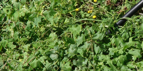
The above photo was taken with a telephoto lens. There was no signage anywhere to indicate the presence or significance of the plant, just a rough netting fence enclosing the site, so my identification is based on comparison with other online photos.
However, while the original concept for the stonefields reserve seems to me a valuable one, once the setup was finished there appears to have been little more in the way of maintenance or development, apart from mowing the area around the front gate and spraying the (repaired section of) dry stone wall with weedkiller. Preservation, conservation, are not the same as neglect.
(Mangere does translate as "lazy" I believe, though the original and larger name for the area was Hau Mangere — lazy winds — giving it quite a different ambience.)
I am puzzled by this, for in most areas I have visited, Maori marae, Maori churches, urupa and waahi tapu in general are normally kept immaculately, and this is not the case here.
Paths are indistinct, I imagine as much from want of use as anything else, and marker posts are sometimes difficult to track - you'd need X-Ray vision to discover the whereabouts of H25 from H24 without a map, for example. (Of which, more later.)
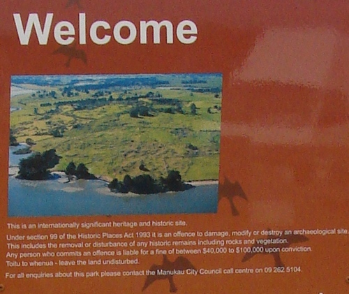
Information which would bring the area to life for the casual visitor is largely missing, unless one is prepared to take the time over a variety of internet sites, to assemble information beforehand - and even that's scanty. Without it, one is looking at a couple of low hills, scrubby vegetation, rocks, kikuyu and cowshit, and a "Welcome" notice (in English) warning that the removal of any of these or of any part of any of these, attracts a minimum fine of $40,000 if convicted.
A report of a Manukau City Council Treaty of Waitangi Committee meeting on 10 July 2008 includes the following:
"Council is currently exploring development of a globally significant heritage visitor
experience at the Otuataua Stonefields. The earlier proposal was for a locally focused visitor centre with limited potential to create economic benefit to Mangere. This new concept will create job opportunities for local people. The proposal has been
developed by Tourism Auckland, Saul Roberts from Makaurau Marae and Manukau
City Council. Discussions have taken place with Te Wai o Hua marae (including
representatives of Pukaki, Te Puea and Te Manukanuka o Hoturoa) in relation to this
proposal and the opportunities for development of tourism businesses and traditional
crafts and arts has been canvassed."
Two years later, there is nothing on the ground to show for this. All the "new concepts" in the world will create nothing unless they are translated into bricks and mortar. (Though, at quite another level, I am relieved at the inaction. The thought of a bustling car and buspark with tour guides for hire, shops full of fast food, coffee, Footrot Flats dogs, moko skin transfers and souvenirs manufactured in China, makes me shudder.)
(Post Script. We were told about this and shown the projected site on our guided walk, so I gather it has not completely vanished from the horizon.)
(I am interested, too, that on a site as emphatically Maori as this one is, the words Haere Mai are missing from the Welcome sign, though "Toito te whenua — Leave the land undisturbed" does get a mention.)
It is instructive to read the Notice of Requirement that designates a swathe of rural land surrounding the stonefields as "public open space". This effectively means that the present owners are unable to sell it, nor does it warrant developing, and nor do the involved local bodies need to spend money buying it, at least in the immediate future.
All contributors to the hearing acknowledge the ultimate spiritual value to Maori of the waahi tapu that is the Stonefields Reserve. The commissioners, in so creating a buffer around the stonefields, are seeking to protect the stonefields from inappropriate adjoining activities. Which is OK as far as it goes, but it does create a limbo in which it makes no sense at all to invest further in the land, or maintain existing structures.]
It would be especially rewarding to the serious student to have some knowledge of the basis on which this recognition of spiritual value is made, but we are told:
"There are various sites throughout the [Mangere] area that are of cultural or spiritual significance to the people of Makaurau Marae. However, as one Marae member put it, most of the details surrounding the purpose, location and significance of these sites is sacred knowledge, and to list them in a report would make it common knowledge, and therefore subject to common theft. For this reason, the specifics of the sites are not included in this report."
Hmmmmm.....
As far as I have any little awareness of Maori spiritual practice gained from my healing work with numbers of Maori clients over the years, and from my own background of mysticism, I would personally affirm that there are areas within the stonefields that are commandingly sacred — as there are also such areas in the Waitakere forests, and at Kaipara South Head and in the beech forests in the Ureweras, to name but a few examples from my own experience. However, beyond being aware of these locations as different in kind from other "non-sacred" locations, I have no detailed knowledge of the territory as it might be embodied or expressed in Maori culture and tradition. It would be something...
So, as far as I am able, then, this series of photo reports represents my best efforts to assemble in one place all that a casual visitor might find useful in making this walk an opportunity for repeated visits and close examination, and eventually, I hope, to gain a sense of the special quality of the area. I think it's worth it. There are three walks, a historical walk, a botanical walk and a geological walk. Photographs are mine from a series of visits. Information and comment is provided as found, with appropriate acknowledgement.